Connect with us

Top Stories

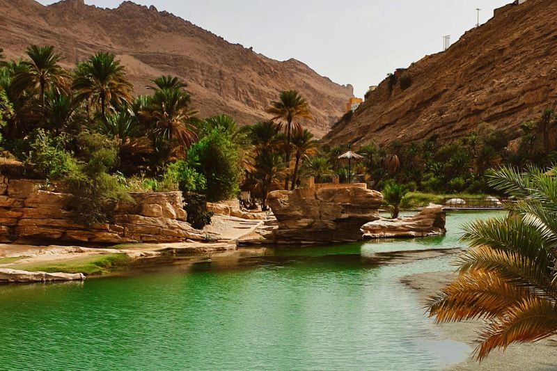
How to Download Topographic Offline Maps for Safe, Disconnected Camping in Oman’s Wadism

Published

on

oman camping offline maps

The rugged nature of Oman presents the best wild camping experience in the Middle East. Nevertheless, going into these deep and narrow ravines, you are bound to lose the coverage of your mobile network. It is most important to know how to sail without a signal in order to make the adventure experience smooth.

The Importance of Oman Camping Offline Maps

When you are in remote valleys such as Wadi Shab or Wadi Bani Khalid, it is better to rely on a live internet connection that is going to put you lost. By downloading Oman camping offline maps before you hit the road, you guarantee access to critical navigation data regardless of cell service. These electronic maps enable you to monitor your precise GPS positioning, so that you will never lose your campground, your hiking path or your car.

Choosing the Best App for Wadi Topographic Maps

Map applications are not alike. For wilderness exploration, you need high-quality wadi topographic maps that show elevation changes, contour lines, and hidden trails. The Gaia GPS and Mapsme are great applications to use in off-road navigation. Moreover, it can be useful to use AllTrails as an additional webpage to check the accuracy of the hiking trails close to your camping place. It is important to always check the regulations of the area through the official Experience Oman portal so that your preferred location is not a place that is not legally accessible to visitors.

Steps for Safe Disconnected Camping

To prepare for safe disconnected camping, download your chosen map layers while still connected to reliable Wi-Fi. Use the maximum resolution and download areas around you in case you are taking a detour. Also do not forget to bring a high capacity power bank that will keep your phone charged.


Experience Oman Instagram.

Frequently Asked Questions

1. Which apps are best for off-grid camping in Oman? 

Apps like Gaia GPS, Maps.me, and AllTrails are highly recommended because they allow you to download detailed topographical layers and trail paths for offline use.

3. Do GPS features work without a cell signal?

Yes. As long as you have downloaded your offline maps beforehand, your phone’s internal GPS receiver can track your exact location on the map without any cellular service.

4. How do I avoid flash floods?

Never pitch your tent in the direct path of a wadi floor. Always check local weather forecasts beforehand and make sure to camp on higher ground.

Click to comment

Leave a Reply

Your email address will not be published. Required fields are marked *

Trending